The Dolomites World Heritage Geotrail winds its way through the entire fossil archipelago of the Dolomites World Heritage Site in forty-seven stages, from the Brenta Dolomites in the west to the Dolomiti Friulane and d’Oltre Piave in the east. Hikers can now explore the geological aspects of the latter two areas thanks to the fourth guide, which completes this extraordinary journey through space and time with the last ten stages.
The allure of geologic time
Photos, diagrams, maps, and rigorous but extremely simple descriptions, edited by geologists Emiliano Oddone and Tommaso Trentini for the Dolomites Project, guide visitors step by step into the distant past which gave rise to the Cridola, Spalti di Toro – Monfalconi, and Pramaggiore groups as well as the Ressetum – Raut ridge, the areas between Monte Duranno and Monte Borgà, and the Vajont Valley on the border between Friuli Venezia Giulia and Veneto. Ten stages take them through breathtaking dolomitic landscapes whose natural allure is relayed to the eyes of the observer through its most untouched pages. The particular focus of the volume published by Athesia is on twenty-seven unique geological features that illustrate the geological and geomorphological assets that led to the Dolomites being listed as a World Heritage Site.
The Geotrail project
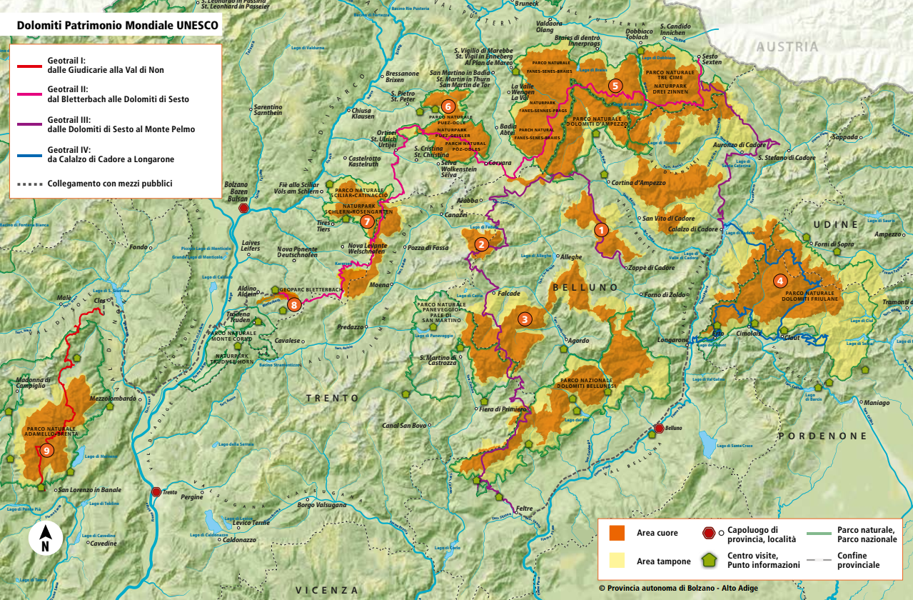
The Dolomites World Heritage Geotrail is a project of the UNESCO Dolomites Foundation born of the initiative of the Autonomous Province of Bolzano – South Tyrol; it has subsequently been extended across the entire Dolomites UNESCO World Heritage Site. The purpose of the trail is to make the exceptional geology of these mountains accessible to everyone with simple, direct explanations and notes regarding ecology, local history and the names of topographical features. As a tool for raising visitors’ awareness of the extraordinary value of the Dolomites, it offers much more than a picture postcard, leading them through a discovery of the incredible and extraordinary geological assets that have made these mountains unique in the world. This understanding, in turn, can help make hikers more respectful of the environment they are visiting. All information on trekking, including logistical information such as the stopovers provided in the mountain huts or at the bottom of the valley, is available at this link. As mentioned, the volume dedicated to the Dolomiti Friulane and d’Oltre Piave is the fourth in an editorial project that has already published a first volume on the six stages leading from the Giudicarie to the Val di Non, a second volume on the ten stages from Bletterbach to the Sexten Dolomites, and a third volume offering useful information for tackling the 21 stages that lead from the Sexten Dolomites to Monte Pelmo.
Ph. Luciano Gaudenzio